Quick Information about Hikes
Difficulty to Moul Falls: Easy
Difficulty from Moul to McDiarmid Falls: medium +
Time to Moul Falls: 2 hour round trip
Time from Moul to McDiarmid Falls: 1 hour round trip
Distance to Moul Falls: 6 km round trip
Distance from Moul to McDiarmid Falls: 1 km round trip
Elevation Change to Moul Falls: 120 meter decent
Elevation Change from Moul to McDiarmid Falls: 120 meters
Best Time of Day to Visit: Late afternoon to get the sun gleaming on the falls
Driving Information:From the Wells Gray Tourism Center you will turn right on the Clearwater Valley Road. This road is the only access to the park corridor. Drive 20.8 km up the park road until you see a parking lot on the left with good signage for Moul Falls.
Trail Conditions to Moul Falls: The first 1.7 km of the trail is a decommissioned road and is quite a gentle walk. Once the road turns to trail following signage to Moul Falls after 30 – 40 minutes walk you will find the trail is still very easy to navigate with no real obstacles.
Trail Conditions from Moul to McDiarmid Falls: The hike to McDiarmid is a bit uphill then mostly downhill. It’s a bit of a slog back up for a novice hiker, but pacing it is key. There is also some shale rock that can be slippery to walk on as it shifts under your feet. This is at the very last part of the downhill and should not deter you from visiting this amazing waterfall!
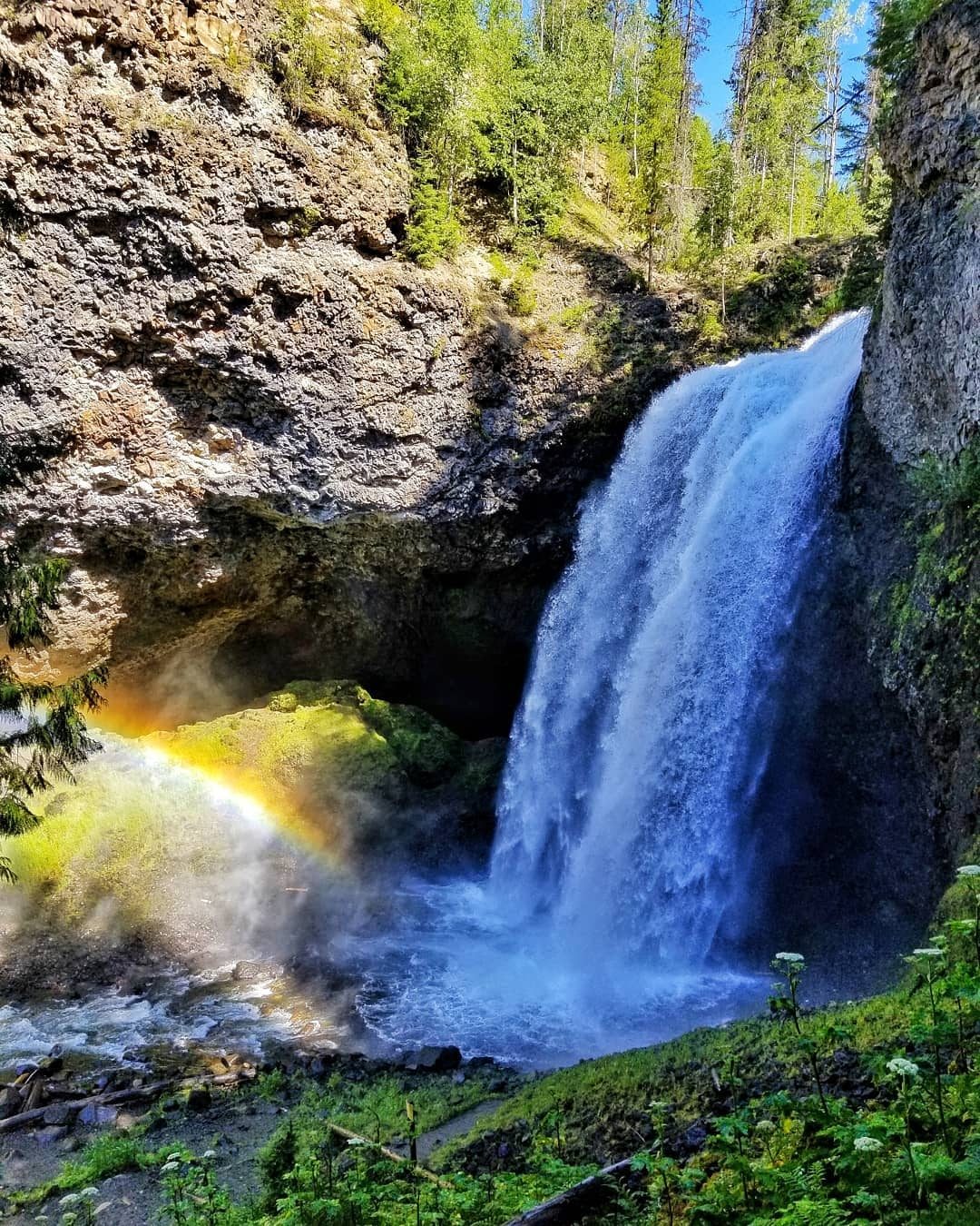
Photo of Moul Falls
Clearwater Valley Corridor Map

Trail Information
The first 1.7 km of the trail is a very old decommissioned forest service road. As such it is a smooth pleasant walk. 30 – 40 minutes down the trail (1.7km) you will see signage for Moul Falls and a trail leading off of the road. This is still a very easy going walk and can be done by most people. Follow this for 1.1 km until you get to the top of Moul Falls (no view of top). The path starts decending for a couple hundred meters into the canyon of Moul Falls. From here you can walk behind the falls.
Moul to McDiarmid Falls
The hike from Moul to McDiarmid is not for the feint of heart. Not considered to technical it is a moderately difficult hike. The hike to McDiarmid is a bit uphill then mostly downhill. It’s a bit of a slog back up for a novice hiker, but pacing it is key. Be careful on the broken up shale rock near the bottom of the downhill. Otherwise, enjoy this majestic rarely seen waterfall!
Disclaimer: Use trails and this information at own risk. Riverside Adventures does not accept any responsibility in the even of an injury or death while hiking these trails. Use of common sense is required while hiking in the mountains.
Safety Information
Safety Information
What to bring:
– Hiking shoes or boots
– Warm layers (depending on time of year)
– long sleeve t-shirt and pants (mosquitoes)
– Bug spray
– Water
– Snacks (or a picnic)
– Bear spray (just in case)
– Book on local Flora/Fauna
– Towel for after walking behind Moul Falls
What to look out for:
– Bears (if you see cubs mama is near by)
– Mosquitoes
– Tripping hazards
– Devils Club (you would have to leave the trail)
– Shale Rock between Moul and McDiarmid (lots of broken small rocks downhill that can make you slide)